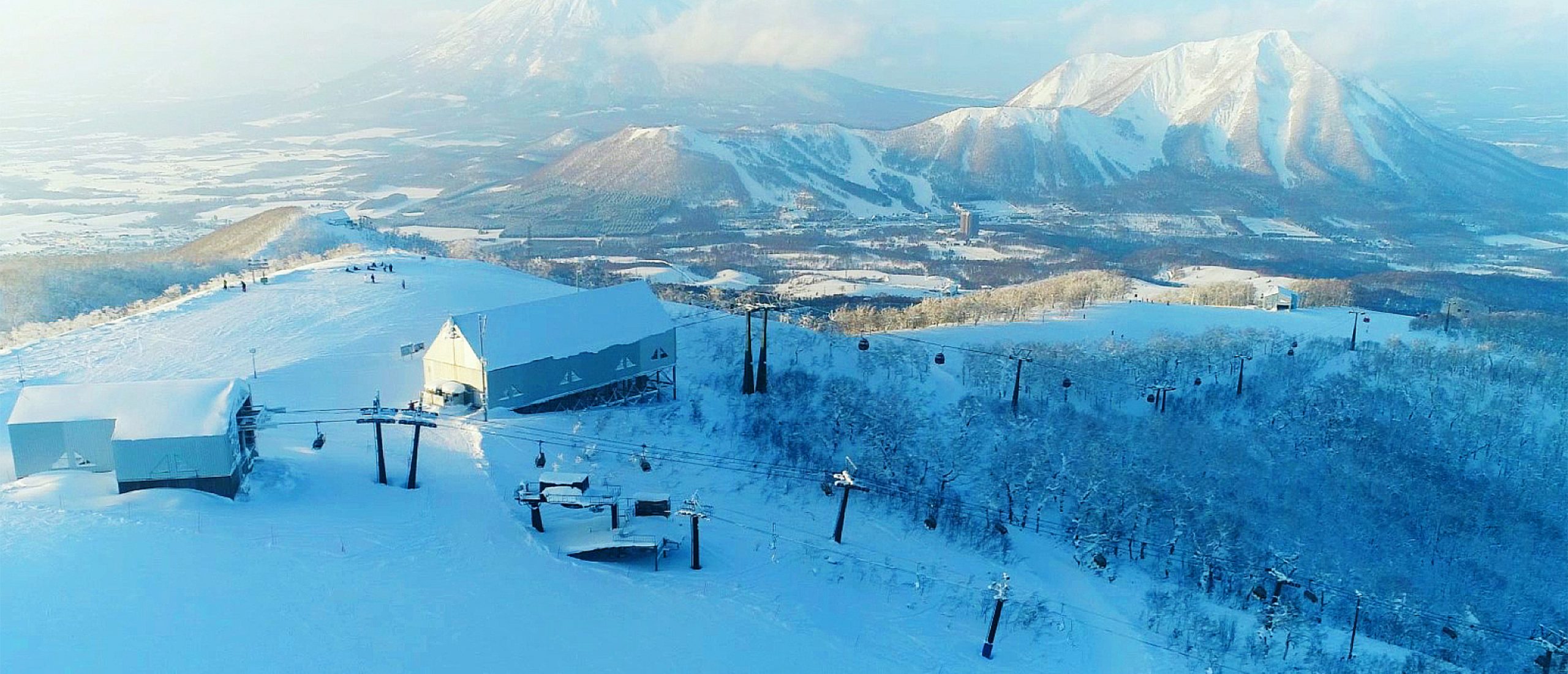
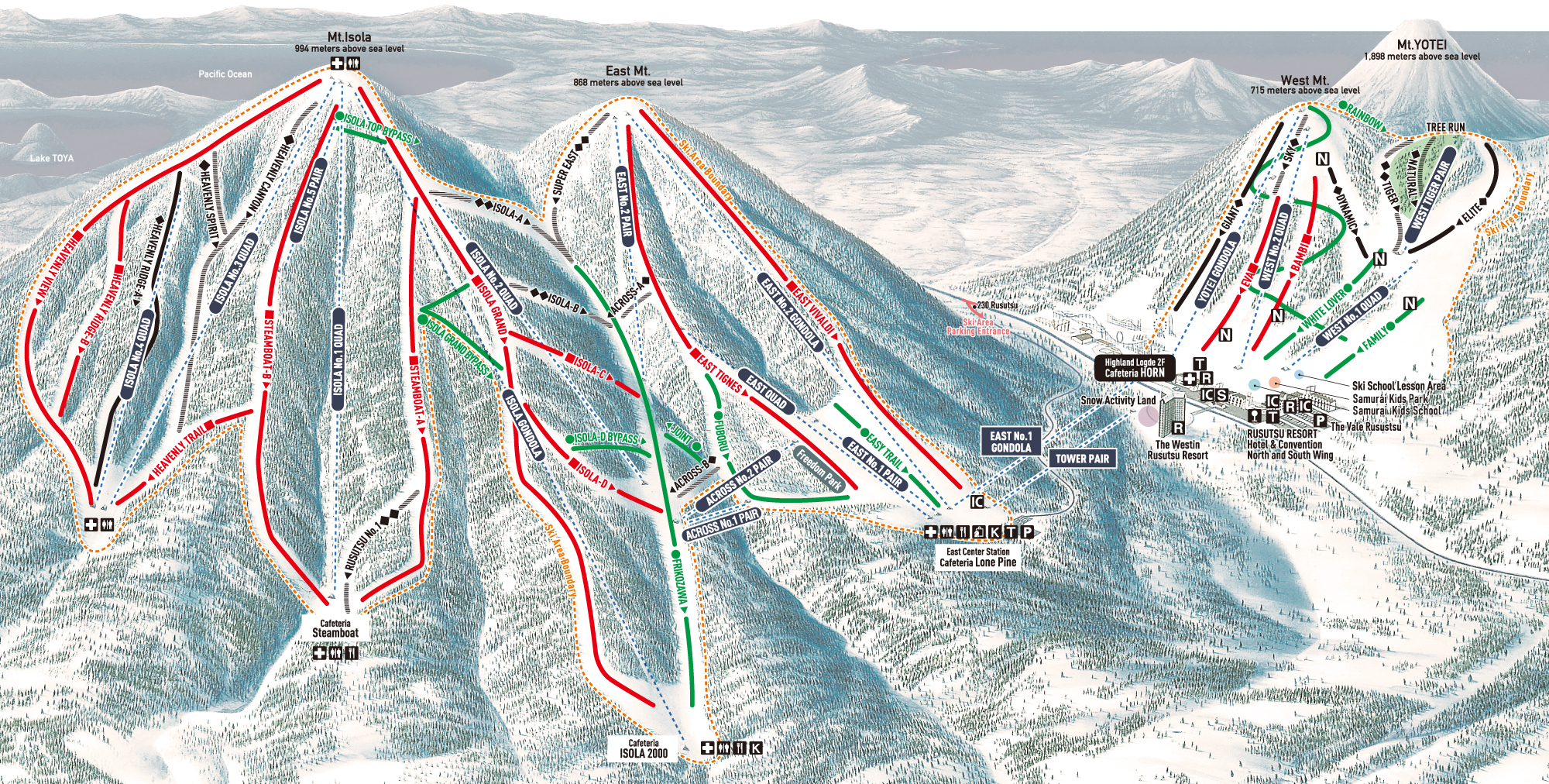
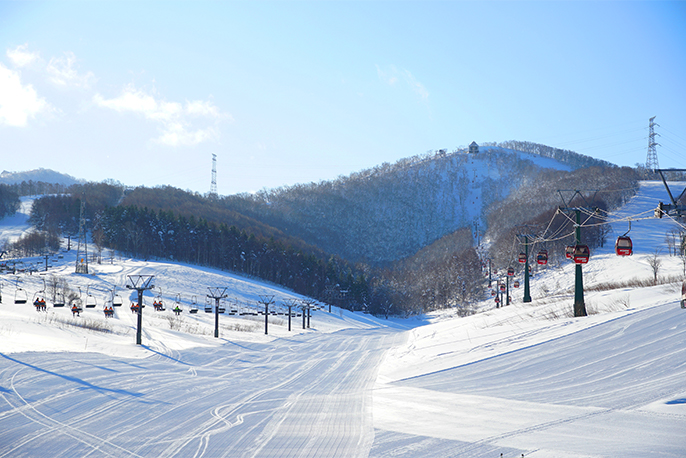
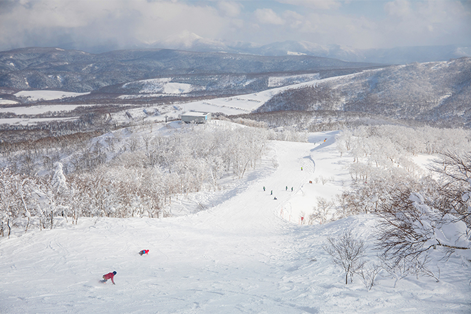
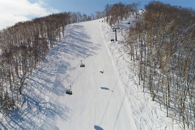
WINTER TRAIL MAP
+
–
- Expert
- Advanced
- Intermediate
- Beginner
- Ungroomed Trail
- Night Skiing Area
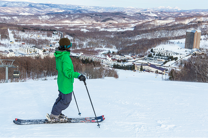
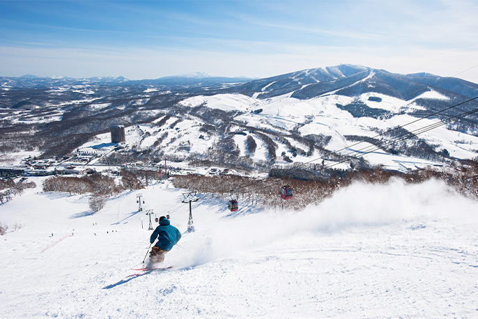
West Mt.
-
Family
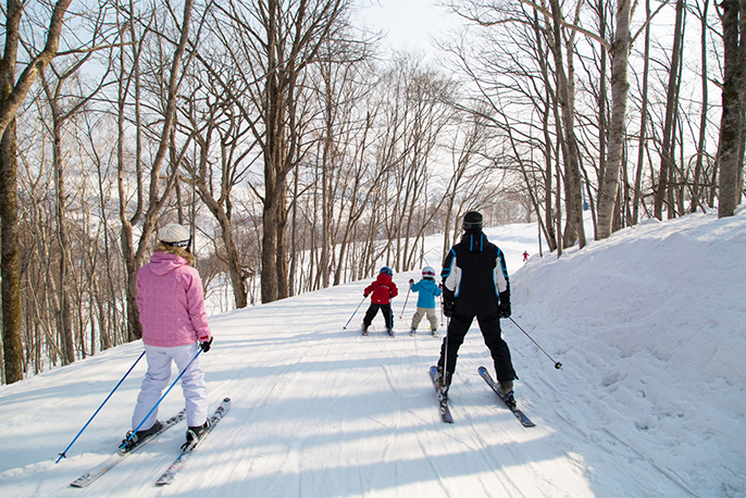
A wide trail with a constant gradient, Family Course is ideal for beginners. Conveniently located right in front of Rusutsu Resort Hotel, this trail attracts many skiers. Its proximity to Kids Park makes it great for kids aiming to advance to the next level.
- Distance
- 650m
- Slope
- Average 10°/ Maximum 12°
- Level
- Beginner
-
White Lover
A wide, straight trail from West Mt., White Lover is a perfect Slope for beginners getting in some practice. This trail is also great for experts to enjoy carving turns while speed changes.
- Distance
- 650m
- Slope
- Average 10°/ Maximum 11°
- Level
- Beginner
-
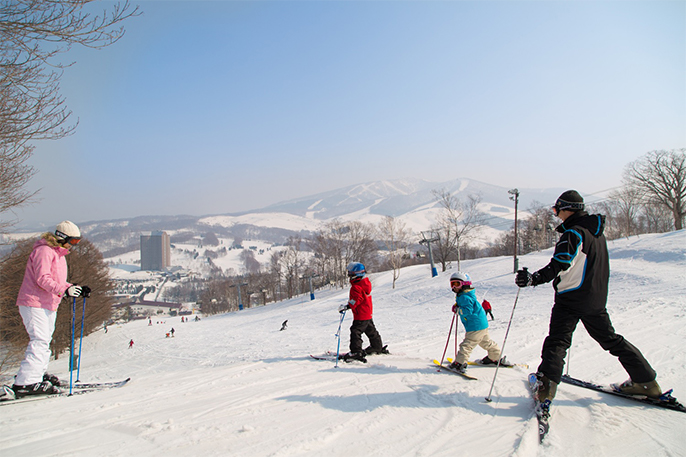
BambiNight Sking Area
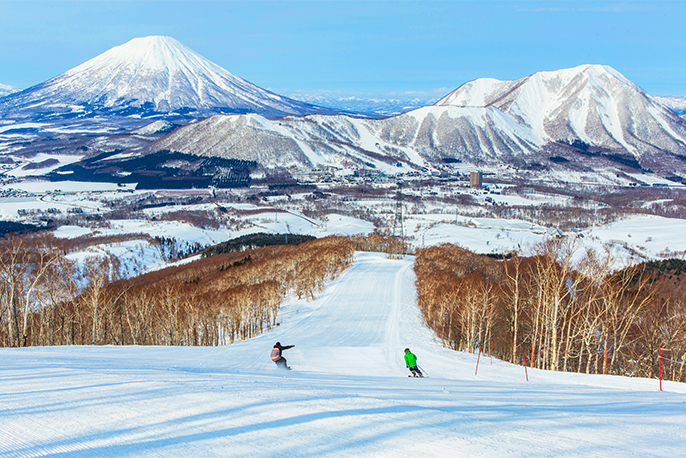
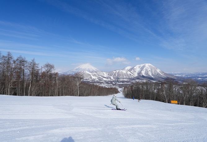
Running along a vast ridgeline near the peak of West Mt., Bambi offers a vast panorama of the magnificent Mt. Shiribetsu. Designed for beginners and intermediate skiers, the gradually changing steepness is the place to go for a refreshing cruise.
- Distance
- 650m
- Slope
- Average 18°/ Maximum 21°
- Level
- Intermediate
-
EvaNight Sking Area
Eva is West Mt.’s signature trail. The first half of this trail is short but varies in steepness. The trail’s stepwise Slope offers excellent conditions for intermediate skiers and snowboarders preparing to tackle steeper trails. This ski run is home to fireworks festivals and torchlight skiing on Christmas Eve and New Year’s Eve.
- Distance
- 650m
- Slope
- Average 14°/ Maximum 21°
- Level
- Intermediate
-

Elite
The first half, which runs through the forest, is a gentle wide forest course. The latter half becomes steeper and is filled with thrilling descents, which makes it a favorite advanced course among experts.
- Distance
- 600m
- Slope
- Average 16°/ Maximum 26°
- Level
- Advanced
-

NaturalUngroomed Trail
The pristine forest offers ideal conditions for nimbly darting among the trees. Blanketed in uncompressed snow, this appropriately named trail caters perfectly to experts. With undergrowth and twigs cleared away, this well-manicured trail attracts confident skiers seeking the dynamic feeling of slicing through the snow.
- Distance
- 750m
- Slope
- Average 16°/ Maximum 26°
- Level
- Advanced
-
TigerUngroomed Trail
Tiger begins at the upper reaches of Mt. Shiribetsu, which forms part of West Mt. Snow on this trail is usually left uncompressed after snowfalls. Aptly named for its ferocious nature, Tiger offers outstanding conditions for the advanced-level powder fans who flock to this hidden gem. This trail is also noted for its beautiful moguls, which are a product of its constant steepness.
- Distance
- 300m
- Slope
- Average 22°/ Maximum 29°
- Level
- Expert
-
RainbowNight Sking Area
Rainbow is a meandering trail that begins at the summit of West Mt. A gentle Slope with great visibility and popular with beginners. this trail gives skiers and snowboarders ample opportunity to admire the stunning view on the cruise down. This course aptly derives its name from the rainbow colors of the 7 other trails it connect to along the way.
- Distance
- 2,000m
- Slope
- Average 8°/ Maximum 13°
- Level
- Beginner
-
DynamicNight Sking Area
A straight trail beginning on the hillside of West Mt., Dynamic is popular among speed-demons for its vast and well-groomed path, ideal for quick acceleration as well as fast, exciting carving turns.
- Distance
- 650m
- Slope
- Average 17°/ Maximum 25°
- Level
- Advanced
-
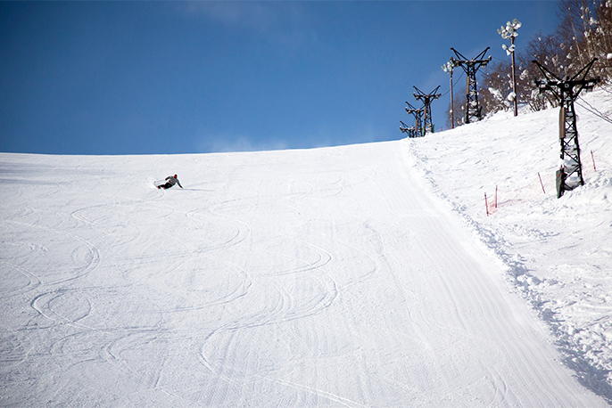
SkyUngroomed TrailNight Sking Area
Blanketed in uncompressed snow, Sky begins just below the summit of West Mt. After snowfalls, many skiers hit this Slope for the fine powder unique to West Mt. Past the stop of West No.2 Quad Lift, is the place to enjoy some deep moguls.
- Distance
- 500m
- Slope
- Average 15°/ Maximum 27°
- Level
- Advanced
-

Giant
Giant is a steep Slope that runs straight down from the summit of West Mt. to the Amusement Park at the mountain’s foot. This well-groomed trail is great for smooth acceleration. What’s more, there’s the unique experience of gliding down the mountain straight toward a Ferris wheel!
- Distance
- 1,200m
- Slope
- Average 13°/ Maximum 26°
- Level
- Advanced
East Mt.
-
East Vivaldi
A long trail stretching over 2,000 meters from the peak of East Mountain, East Vivaldi starts out relatively steep. But once you’re on your way, the Slope alternates between gentle and steep gradients in a comfortable rhythm. The latter half of this trail features rolling terrain perfect for a mellow cruise down the mountainside.
- Distance
- 2,300m
- Slope
- Average 11°/ Maximum 24°
- Level
- Intermediate
-
Easy Trail
Easy Trail is Rusutsu’s gentlest trail. Accessed using by East No.1 Pair Lift, this couse is thoughtfully designed to keep new skiers and boarders safely away from other trails. This trail is also perfect for children that have just learned to ski on their own. What’s more, this kid-friendly trail is nice and wide for first-time skiers and snowboarders.
- Distance
- 750m
- Slope
- Average 7°/ Maximum 8°
- Level
- Beginner
-
Fuboru
Fuboru is a meandering trail branching off the hillside of East Tignes. This trail’s vast and rolling terrain takes beginners on a pleasant cruise through the forest while offering excellent conditions for intermediate and advanced skiers aiming to tackle Mt. Isola. Take East Quad Lift to squeeze in as many runs as you can.
- Distance
- 1,200m
- Slope
- Average 8°/ Maximum 16°
- Level
- Beginner
-

East Tignes
Running along the ridgeline from the peak of East Mt., East Tignes is a medium-angle Slope blessed with a picturesque panorama. Past the halfway point the terrain eases, and greets skiers and snowboarders with Freedom Park, which includes a succession of kickers and rails. This long trail offers up a variety of features, suiting snow-lovers of all levels.
- Distance
- 2,500m
- Slope
- Average 11°/ Maximum 19°
- Level
- Intermediate
-

Super EastUngroomed Trail
A sharp Slope beginning at the summit of East Mt., Super East is known as Rusutsu’s steepest Slope. Since snow on this trail is left uncompressed, skiers can indulge in fresh powder after heavy snow falls. This precipitous trail often gets covered in large moguls, making for perfect conditions for technically oriented skiers.
- Distance
- 500m
- Slope
- Average 32°/ Maximum 40°
- Level
- Expert
-

Across AUngroomed Trail
A short route linking East Mt. and Isola Base Station, Across A connects the hillside of East Tignes with Furikozawa. Short but steep, this convenient trail is the place to head for crisp powder turns right after snowfalls.
- Distance
- 300m
- Slope
- Average 29°/ Maximum 33°
- Level
- Advanced
-
Across BUngroomed Trail
Blanketed in uncompressed snow, Across B is a quick shortcut that takes you from Fuboru to Isola Base Station. The trailside often has plenty of powder, which often goes unnoticed by many skiers. Featuring steep terrain, this trail is perfect for advanced skiers.
- Distance
- 200m
- Slope
- Average 22°/ Maximum 33°
- Level
- Advanced
-
Joint
Joint takes you from Fuboru to Isola Base Station. This trail may not be wide, but its moderate Slope helps control the speed, allowing beginners to ski to Mt. Isola without being intimidated.
- Distance
- 200m
- Slope
- Average 7°/ Maximum 8°
- Level
- Beginner
Mt. Isola
-
Furikozawa
A long trail bridging East Mt. and Mt. Isola, Furikozawa is the hub route taken by everyone heading to Mt. Isola. This main artery features gentle, rolling terrain while the geographical features along the stream provide opportunities for advanced skiers and snowboarders to nimbly zip around the walls situated on both sides.
- Distance
- 2,100m
- Slope
- Average 7°/ Maximum 10°
- Level
- Beginner
-

Isola Grand
The first half of Isola Grand is characterized by a ridgeline overlooking Hokkaido’s classic panorama. Past the halfway point, you’ll discover a wide pathway running through the forest. Stretching 3,500m long and Rusutsu’s longest run, this aptly named trail is not to be missed.
- Distance
- 3,500m
- Slope
- Average 12°/ Maximum 20°
- Level
- Intermediate
-

Isola AUngroomed Trail
Isola A is the first trail that connects Isola Grand and Furikozawa. Paired with its steepness, this 1,000-meter-long trail has what it takes to satisfy even the experts. Expect to cut through uncompressed snow covered in moguls and often find plenty of dry power right after a snowfall.
- Distance
- 1,000m
- Slope
- Average 24°/ Maximum 27°
- Level
- Expert
-
Isola BUngroomed Trail
The second trail that connects Isola Grand and Furikozawa, Isola B starts out gentle, but turns steep past the halfway point. Snow on this trail is left uncompressed, and snowdrifts may form either on the right or left side depending on the wind. Moreover, you’re often greeted by deep moguls, depending on the line you follow.
- Distance
- 800m
- Slope
- Average 22°/ Maximum 25°
- Level
- Advanced
-
Isola C
The third trail connecting Isola Grand to Furikozawa, Isola C offers up neatly compressed snow, allowing you to maintain speed on the glide down from Isola Grand. Skiers can take East No.2 Pair Lift up to East Mt. from the junction of the two trails.
- Distance
- 550m
- Slope
- Average 17°/ Maximum 25°
- Level
- Intermediate
-
Isola D
Isola D is the fourth trail connecting Isola Grand and Furikozawa. Blanketed in compressed snow, this wide, gentle trail is ideal for all levels of skiers and snowboarders. Immediately past the junction of the two trails, you’ll see Mt. Shiribetsu as it emerges right in front of you. Don’t miss this picturesque and fleeting view.
- Distance
- 800m
- Slope
- Average 13°/ Maximum 21°
- Level
- Intermediate
-
Isola D Bypass
Isola D Bypass is a forest run that takes you on a detour from the lower half of Isola D as it gets increasingly steeper. Beginners should take Across No.2 Pair Lift for an easy trip back to East Mt. from Furikozawa.
- Distance
- 380m
- Slope
- Average 12°/ Maximum 14°
- Level
- Beginner
-
Isola Summit Bypass
Isola Summit Bypass is a beginner-friendly return pathway designed for an easy trip back to East Mt. from Mt. Isola. Thoughtfully designed, this trail allows you to switch to the gentle Slope of Isola Grand as you cruise down the broad pathway of Steamboat B.
- Distance
- 350m
- Slope
- Average 6°/ Maximum 10°
- Level
- Beginner
-
Isola Grand Bypass
Detouring from the steep part of Isola Grand, Isola Grand Bypass allows beginners to switch between the trails without being intimidated. This bypass route also acts as a return route from Steamboat A.
- Distance
- 690m
- Slope
- Average 10°/ Maximum 16°
- Level
- Beginner
-
Steamboat A
Steamboat A runs along a ridgeline coming from the Isola No.2 Quad stop to the Steamboat cafeteria. This trail may not be as vast as Steamboat B, but rarely gets crowded. Situated in the middle of the forest, this hidden gem offers ideal conditions for a tranquil cruise.
- Distance
- 2,200m
- Slope
- Average 12°/ Maximum 26°
- Level
- Intermediate
-
Steamboat B
Mt. Isola’s signature trail, Steamboat B, boasts a distance of 2,100 meters. With its wide, consistent slope and excellent visibility, this flagship run offers enjoyable cruising for a wide range of skiers, while also delivering exhilarating turns for more advanced riders.
- Distance
- 2,100m
- Slope
- Average 12°/ Maximum 26°
- Level
- Intermediate
-
Rusutsu No. 1Ungroomed Trail
Branching off Steamboat A, Rusutsu No.1 is a surprisingly steep Slope blanketed in uncompressed snow. Straightforwardly named, this advanced trail tops the list of Rusutsu’s most challenging trails. On hitting this precipitous Slope that reaches up to 35 degrees, you can expect to find deep moguls formed along the path.
- Distance
- 380m
- Slope
- Average 22°/ Maximum 35°
- Level
- Expert
-
Heavenly CanyonUngroomed Trail
Located at the deepest part of Mt. Isola, Heavenly Canyon is the signature trail of the Heavenly area. Situated along a stream. this trail receives plenty of snow carried in by the wind. With the entire distance stretching 1,850m, this landmark run attracts both skiers and snowboarders seeking quality powder.
- Distance
- 1,850m
- Slope
- Average 13°/ Maximum 29°
- Level
- Advanced
-
Heavenly SpiritUngroomed Trail
While starting out gentle, with this trail you can maintain high speed as you switch from Heavenly View. Including a 500-m Slope of up to 22 degrees, this trail offers ideal conditions for indulging in Rusutsu’s dry power.
- Distance
- 550m
- Slope
- Average 19°/ Maximum 22°
- Level
- Advanced
-
Heavenly View
The outermost trail from the summit of Mt. Isola, Heavenly View is characterized by flat, moderately-steep terrain great for fast runs down the mountainside. Named for its beautiful panorama, on sunny days this trail looks over the entire area around Lake Toya and Shikotsu Toya National Park. This vista can extend as far as Hokkaido Koma-ga-take.
- Distance
- 2,700m
- Slope
- Average 9°/ Maximum 16°
- Level
- Intermediate
-
Heavenly Ridge A
Featuring terrain of gradually varying steepness, this trail offers perfect conditions for the stimulating experience of controlling your steps according to the gradient, which reaches up to 30 degrees. This advanced high-speed piste is blanketed in thoroughly compressed snow, enabling your edges to cut briskly into the surface. If it’s carving and fast turns you crave, this is the trail for you.
- Distance
- 1,250m
- Slope
- Average 14°/ Maximum 30°
- Level
- Advanced
-
Heavenly Ridge B
Branching off from Heavenly View, Heavenly Ridge B is a wide piste that takes you through the forest. In addition to the step-like changes in steepness, the “selective grooming” (e.g. snow on the trail sides is left uncompressed) offers skiers and snowboarders plenty of stimulation. This trail also offers perfect conditions for beginners who are still getting used to uncompressed snow.
- Distance
- 1,000m
- Slope
- Average 12°/ Maximum 20°
- Level
- Intermediate
-
Heavenly Trail
This 350-m trail is a convenient short route that takes you from the Steamboat area to the Heavenly area. Its gentle Slope running through the forest attracts skiers seeking a laid-back ambiance for cruising.
- Distance
- 350m
- Slope
- Average 15°/ Maximum 18°
- Level
- Intermediate
Terrain Parks
-

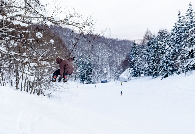
Freedom Park
In this moderately-sized park, you’ll find an easy lane thoughtfully designed to allow beginners and intermediates to land safely, and an expert lane challenging enough for confident, advanced-level skiers and snowboarders. With setups for jumps and jibs, this park rounds out a perfect freestyle-oriented environment.
- Level
- Advanced
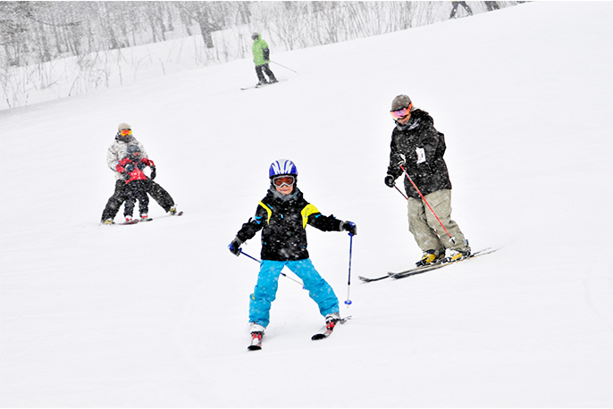
Kids Parks
-

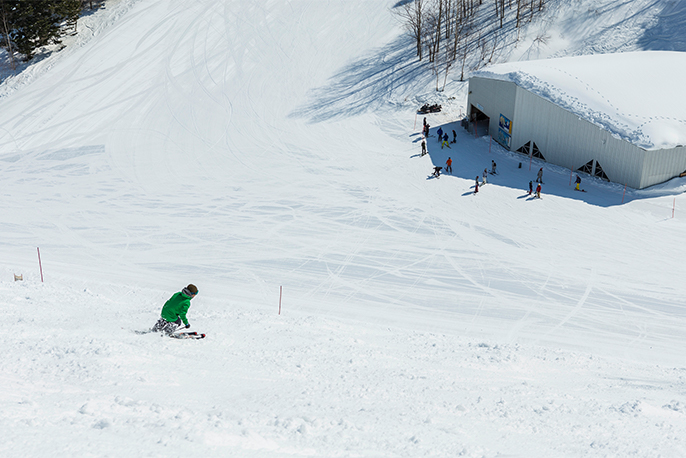
Samurai Kid’s Park
Featuring gentle terrain, this snow playground is set up with facilities for sledding, tubing and snow biking. The park also has snow escalators, making it easier for young kids to throw themselves into fun snowplay.
- Level
- Beginner
-
- Equipment that can be worn/carried on gondolas and lifts
-
- ・Skis
- ・Snowboard (*1)
- ・Mini-skis (*1)
- ・Snowskate (※1)(※3)
- ・Snow Scoot (*1)
- ・Chair Ski (*1)
- ・Snow Moto (*1)(*4)
- ・Swaky (*1)
- ・Snow Feet (*1)
- ・Air Board (*2)
*1 : Leashes required
*2 : Can only be used on the East Mt. East Vivaldi Course, can only be taken onto the East No. 1 and No. 2 Gondola.
*3 : (March Only) Only the East Tignes Course, Family Course, and White Lover Course are open. Only the East Quad Lift and West No.1 Quad Lift are in operation.
*4 : Seat parts should be removed or folded into.
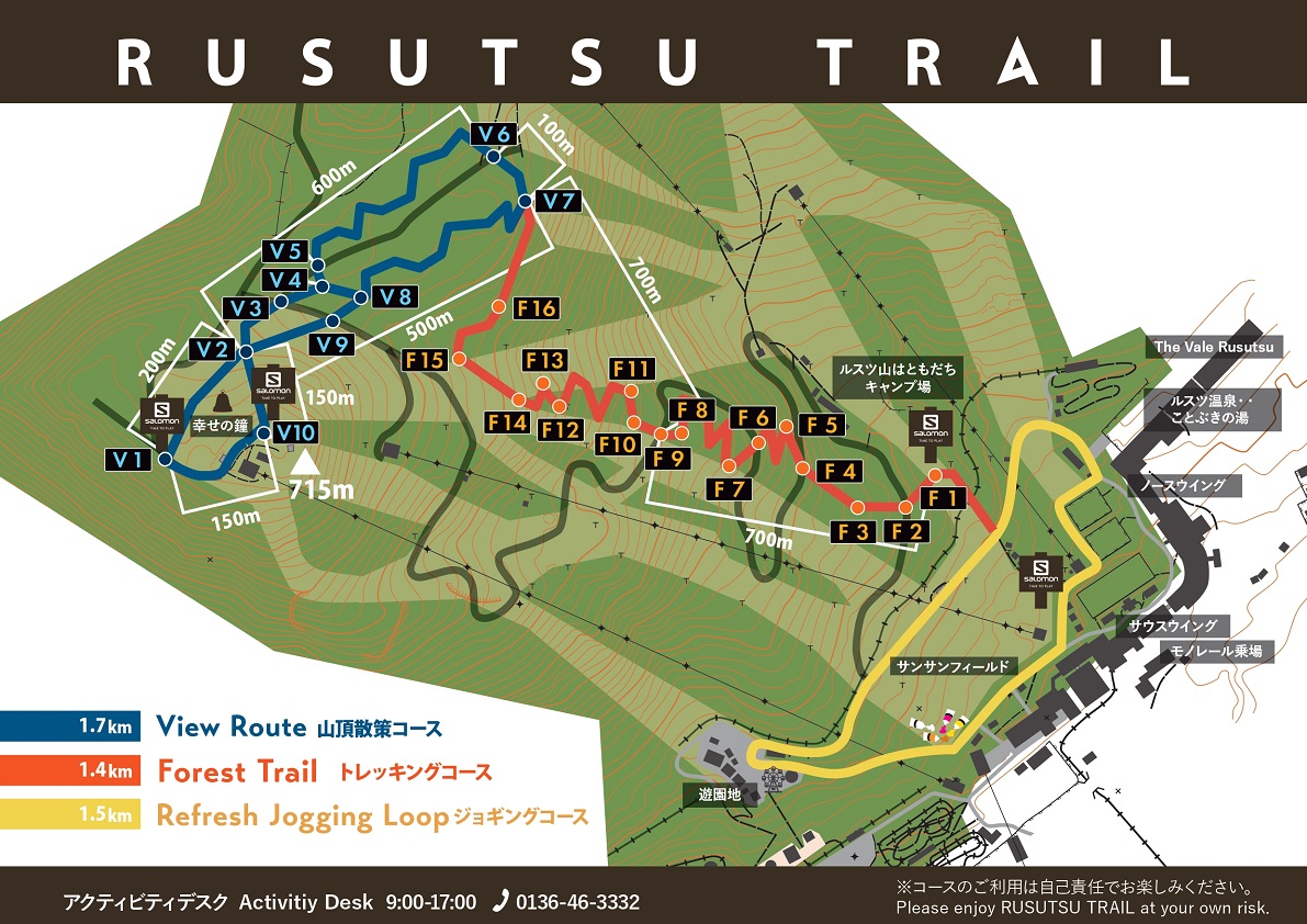
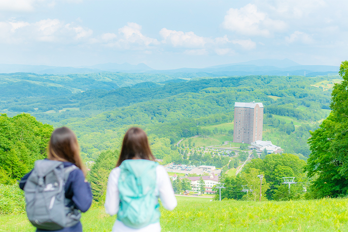
SUMMER TRAIL MAP
+
–
-
View Route
Explore the summit of West Mt. as you head down this hiking trail blessed with a pleasant mountain breeze. Treat yourself to the stunning landscape while refreshing your mind and body as you admire the panorama of Mt. Shiribetsu and Lake Toya. The entire path maintains more or less the same altitude, so anyone can walk it without difficulty.
- Distance
- 1,900m
- Level
- Intermediate
-

Forest Trail
A 1.5-km trekking trail running from the mountain foot to the summit, Forest Trail takes you on a pleasant hike through the forest that sprawls along the ski trail. This forest pathway is noted for its soft black soil, which lends a gentle texture ideal for walkers and runners alike. You can also take the gondola up to the summit and hike back down the trail.
- Distance
- 1,500m
- Level
- Intermediate
-
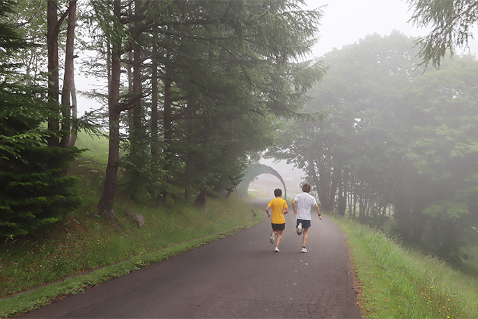
Refresh Jogging Loop
This 1.5-km paved trail weaves around the area in front of Rusutsu Resort Hotel. The flat terrain is great for both jogging and walking, suiting visitors with different energy levels. Let the cool, fresh breeze wash over you, an amazing feeling early on a summer’s morning.
- Distance
- 1,500m
- Level
- Beginner